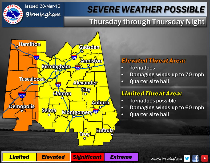
Tuscaloosa will be in an “elevated threat area” for tornados and other severe weather on Thursday, the National Weather Service in Birmingham announced Wednesday.
According to the NWS, Tuscaloosa will fall on the eastern edge of the elevated threat area, with isolated tornados, damaging winds and quarter-sized hail likely. The Tuscaloosa area is slated to received around 3.77 inches of rain through Thursday night.
UPDATE (03/31/16, 2 p.m.) The latest maps from the NWS show Tuscaloosa in an elevated threat area from 4 to 10 p.m. Per the NWS, sunshine during the early afternoon could spell increasingly unstable storm systems in the late afternoon.
Locals should have a plan to receive weather information and a plan to shelter in case of emergency. For more on what to do in case of severe weather, click here.
Follow @TheCrimsonWhite on Twitter and Facebook for up-to-date weather coverage.


